
TreeMapper

Simple & Powerful
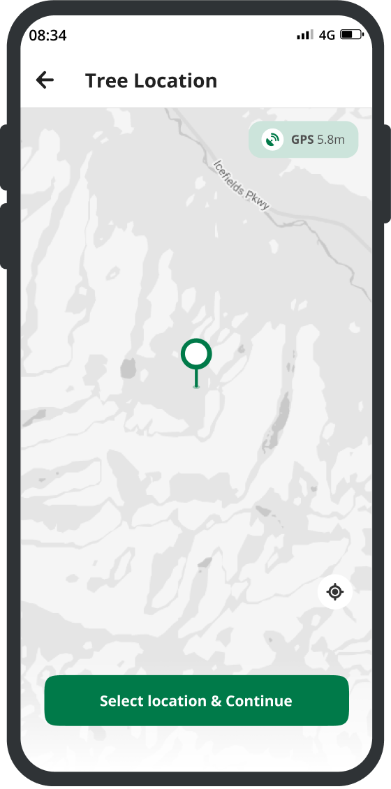
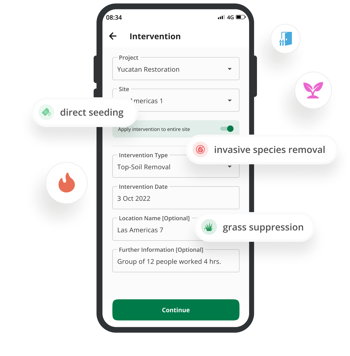
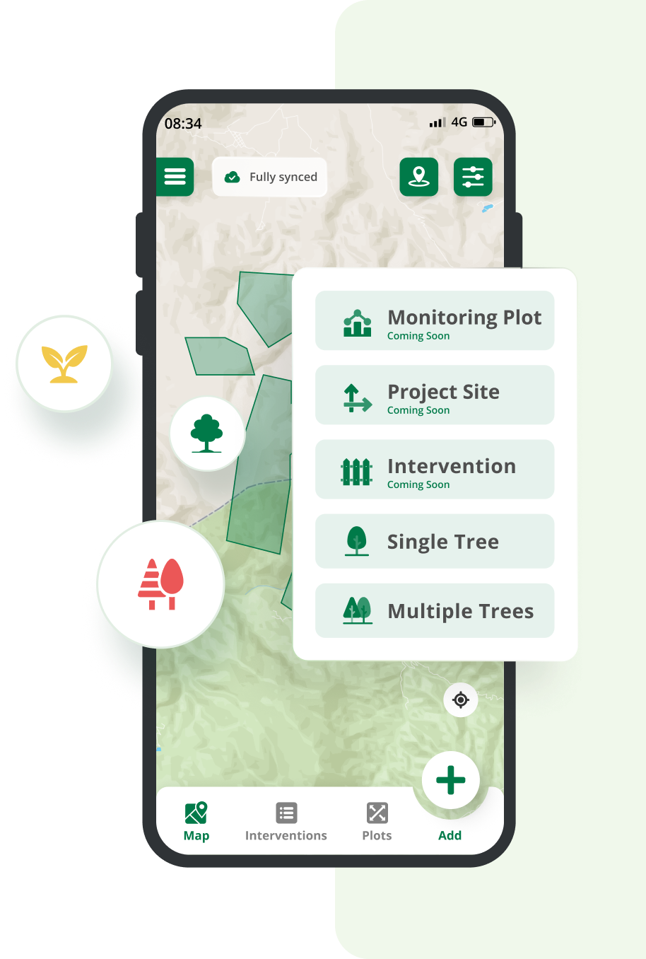
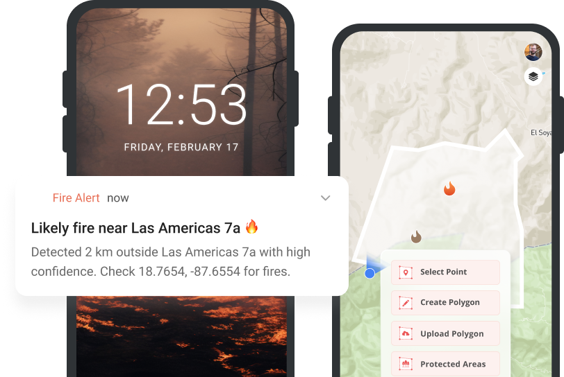
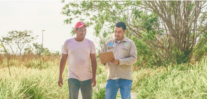
Monitoring restoration interventions is as easy as locate, snap, measure.Built for places with limited or no connectivity
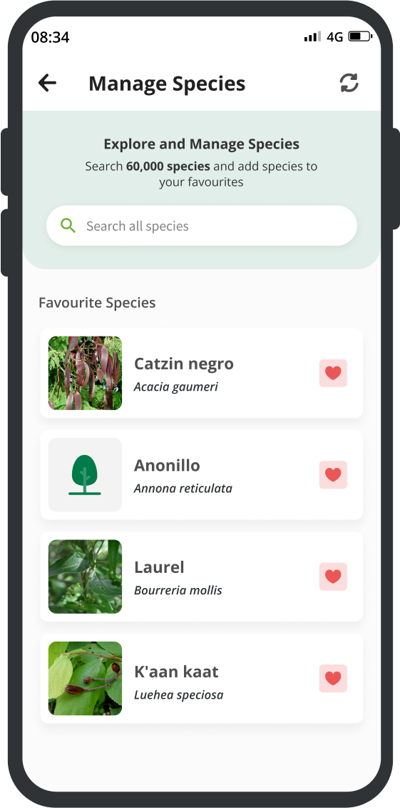
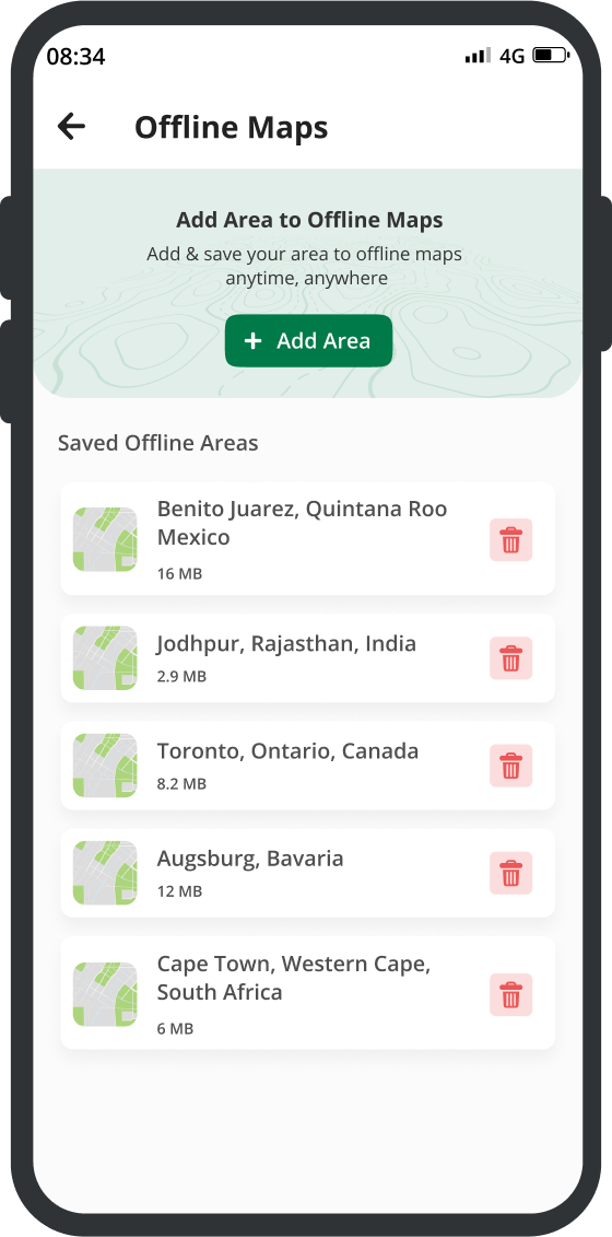
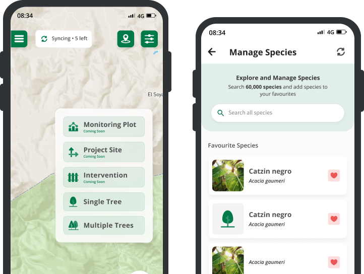
TreeMapper works offline, so you can collect data anywhere. Simply export the data from the device or it can upload automatically when an internet connection is detected60k+ species
and project integration
Add Custom Fields with a Form Builder
Need to gather more data? Customize the app to your needs with a powerful form builder. You can share your forms with anyone using a QR codeMonitoring Plots
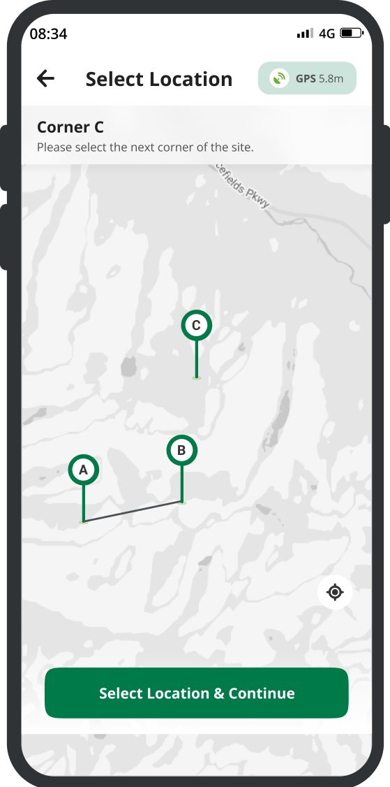
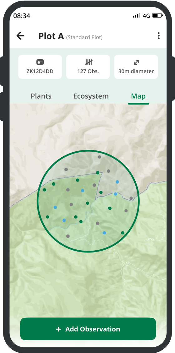
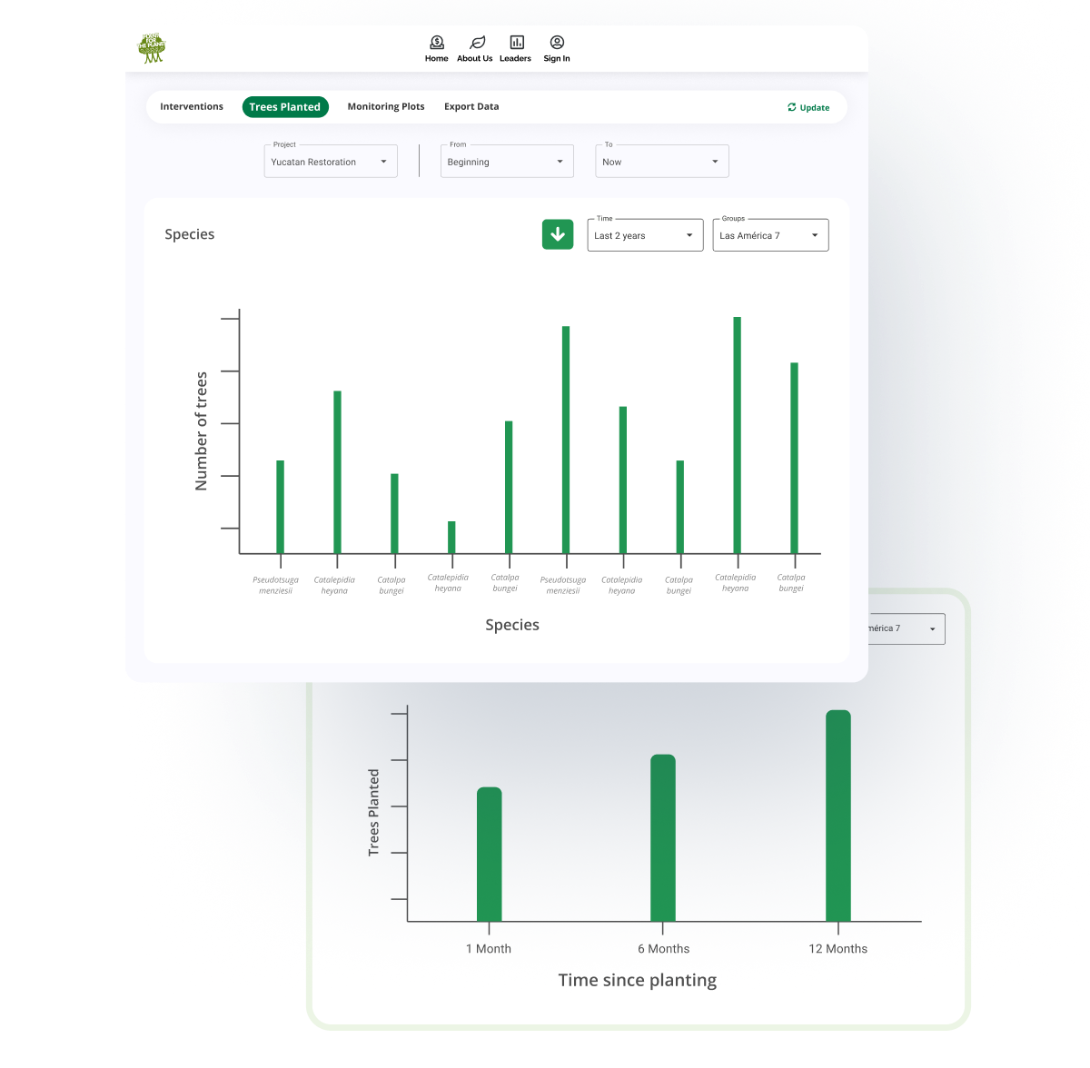
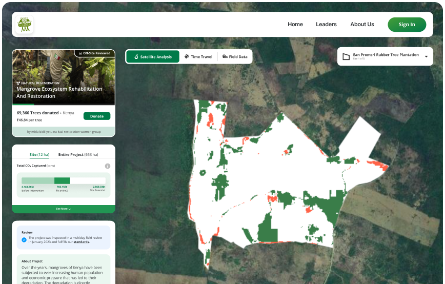
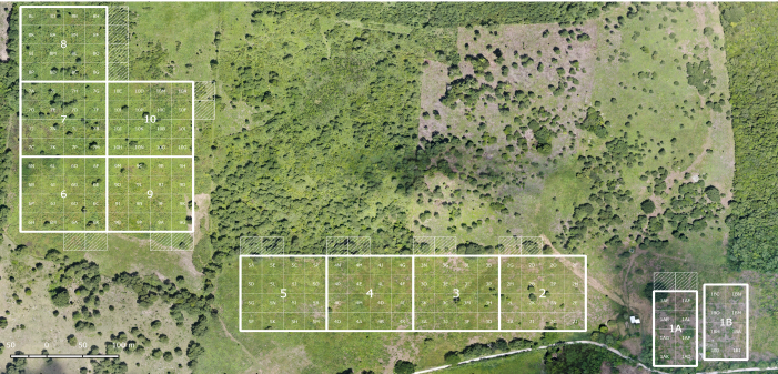
Easily create permanent monitoring plots with the app, collect statistically representative data sets and compare your impact with a no-intervention scenario using paired baseline-plots
Forest Cloud
TreeMapper is Part of Our Forest Cloud
Our free software tools enable the funding, management and monitoring of restoration and conservation projects. 80+ million trees funded so far.SeedManager
for biodiverse ecosystems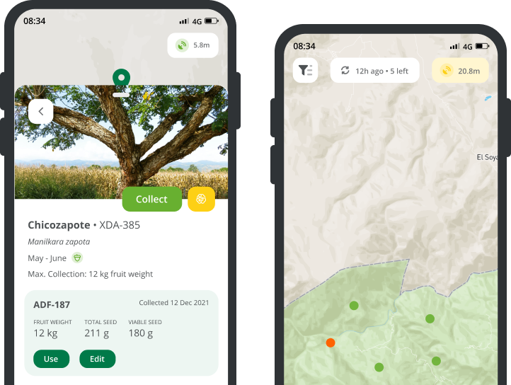
TreeGame
discover the world's forests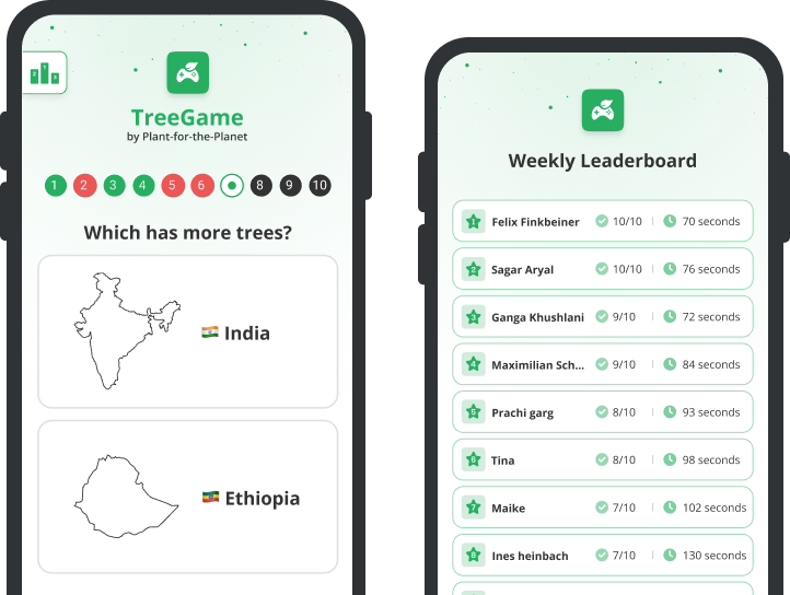
Any ideas how we can improve
TreeMapper? tell us at

Need help using TreeMapper or any of
our other tools?
Maximilian Schmid
maximilian.schmid@plant-for-the-planet.org
👋 Hello Developers!
TreeMapper is built to connect, share and integrate. Take TreeMapper raw data wherever you want. Whether it is to extend the Plant-for-the-Planet platform, for internal use, or for academic analysis, our powerful APIs come in handy. The next generation of TreeMapper will include versioned data to account for any change in the planting locations.
POST /treemapper/plantLocations
{
"type": "multi",
"captureMode": "on-site",
"plantDate": "2021-05-25",
"registrationDate": "2021-05-25",
"plantedSpecies": [
{
"treeCount": 50,
"scientificSpecies": "sspec_1P3ICFW0mNSUk8G8HP"
},
{
"treeCount": 100,
"scientificSpecies": "sspec_RJ9QhdxJ11q2uhyqNq"
}
],
"deviceLocation": {
"coordinates": [
-74.25796508789062,
3.797627553237359
],
POST /treemapper/plantLocations

{
  "type": "multi",
  "captureMode": "on-site",
  "plantDate": "2021-05-25",
  "registrationDate": "2021-05-25",
  "plantedSpecies": [
    {
      "treeCount": 50,
      "scientificSpecies": "sspec_1P3ICFW0mNSUk8G8HP"
    },
    {
      "treeCount": 100,
      "scientificSpecies": "sspec_RJ9QhdxJ11q2uhyqNq"
    }
  ],
  "deviceLocation": {
    "coordinates": [
      -74.25796508789062,
      3.797627553237359
    ]
  }
}


